Exyn Integrates Nexys Autonomous Mapping Platform with CHCNAV X500 UAV
The integration enables nearly 30 minutes of autonomous flight for GPS-denied mapping across mines, tunnels, industrial sites, and enclosed structures.
Image Courtesy: Public Domain
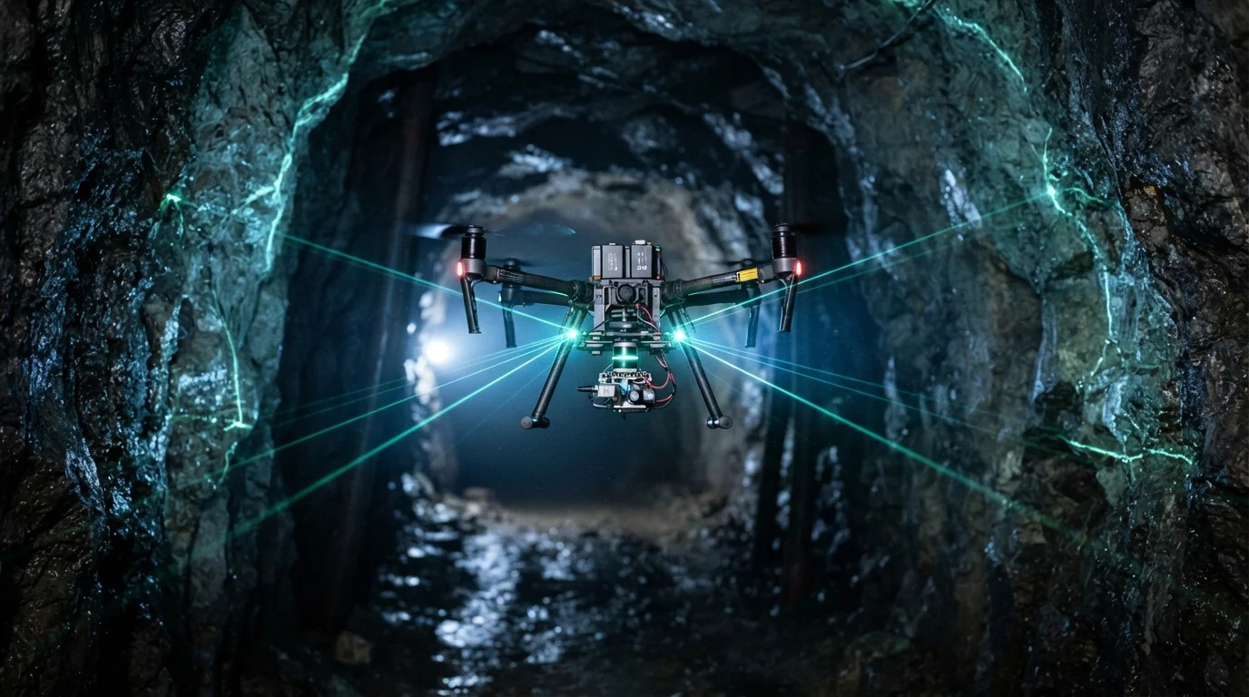
Exyn Technologies (“Exyn” or the “Company”) (NASDAQ: EXYN, EXYNW), a leader in autonomous mapping and AI-powered navigation for complex, GPS-denied environments, today announced the integration of its Exyn Nexys autonomous mapping platform with the CHCNAV X500 (“X500”) professional unmanned aerial vehicle (UAV) — the newest addition to Exyn’s growing ecosystem of supported robotic platforms.
The combined system delivers nearly 30 minutes of autonomous flight, enabling customers to cover larger areas and run longer missions in environments where GPS is unavailable and no prior map exists — underground mines, tunnels, industrial plants and large enclosed structures — without continuous pilot control.
The integration reflects Exyn’s hardware-agnostic approach to autonomy. Rather than requiring customers to adopt a single proprietary aircraft, ExynAI and the Nexys modular payload are designed to extend autonomous mapping across multiple aerial and ground platforms, allowing organizations to select the hardware best suited to the mission — and allowing Exyn to reach new customers without designing, building or supporting aircraft of its own.
“Customers should not have to choose their autonomy software based on a single piece of hardware,” said Ben Williams, Interim Chief Executive Officer and Chief Operating Officer of Exyn Technologies. “Our strategy is to make ExynAI available across a growing ecosystem of trusted robotic platforms, and the X500 is a strong example of that approach. Pairing Nexys with an aircraft capable of more than 30 minutes of autonomous flight gives customers greater flexibility and significantly more time to capture the data they need on every mission.”
Longer Flights, More Data Captured Per Mission
The CHCNAV X500 is engineered for high payload capacity and endurance; when equipped with Nexys, the X500 becomes an autonomous reality capture platform capable of navigating and mapping complex environments without GPS or prior maps. ExynAI’s onboard perception and decision-making allow the integrated system to plan its own paths, avoid obstacles and adapt to changing conditions while capturing high-fidelity 3D data in real time.
With close to 30 minutes of autonomous flight in the integrated configuration, the X500 + Nexys system delivers substantially longer mission duration for applications including underground mapping, industrial inspection, infrastructure surveying, facility digitization and the mapping of large or difficult-to-access environments — more coverage per flight, fewer battery swaps, and less reliance on manual piloting.
Building an Autonomy Layer for a Growing Robotics Ecosystem
Nexys is designed as a modular system that can move between deployment platforms, while ExynAI provides the underlying mapping, localization, navigation and autonomy capabilities. By expanding compatibility across robotic platforms, Exyn intends to give customers the flexibility to deploy the Company’s technology on the aircraft or ground system that best matches the mission.
The integration also supports Exyn’s longer-term strategy of expanding software, SDK, API and OEM opportunities, enabling ExynAI to be incorporated into a broader range of robotic platforms rather than being tied to a single hardware system.
“We believe the long-term opportunity for ExynAI extends well beyond any single drone or robot,” added Williams. “The future of robotics will not be defined by one aircraft or one ground vehicle. As we expand compatibility across third-party platforms, we broaden the range of customers and missions our technology can serve and position ExynAI as the autonomy layer for a growing robotics ecosystem.”
Applications Across Mining, Infrastructure and Industrial Markets
The X500 + Nexys integration is designed to support customers across mining, surveying, industrial inspection, infrastructure and other complex operating environments. By combining extended flight endurance with autonomous GPS-denied navigation and high-fidelity 3D mapping, the system enables organizations to capture more data in a single mission while reducing reliance on manual piloting — and sending fewer people into hazardous spaces.
The integration expands Exyn’s portfolio of supported aerial and ground platforms as the Company continues its strategy of making ExynAI available across a broader robotics ecosystem.
The X500 + Nexys configuration is available to order now through Exyn and its authorized partners.